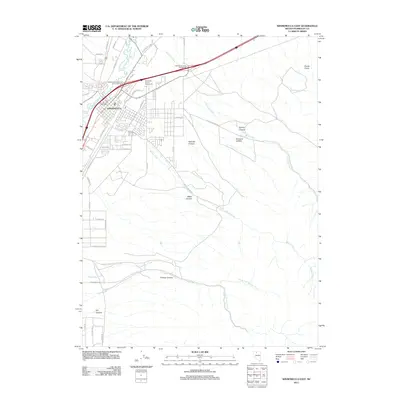
2011 Map of Winnemucca East
USGS Topo · Published 2011About this map
Winnemucca sits at the nexus of the Great Basin's travel corridors, where the Humboldt River curves through the high desert landscape. This 2011 survey captures the eastern expansion of the city, showing the structured grid of streets alongside vital community hubs like the Humboldt County Fairgrounds and the Winnemucca Post Office. To the east and south, the terrain rises sharply into a series of dramatic topographical features. A network of canyons, including Water Canyon, Railroad Canyon, and Kluncy Canyon, channel seasonal drainage toward the valley floor. Notable landmarks such as Giants Grave and its associated Giants Grave Spring provide critical reference points for local history. The map also traces the complex hydrology of the region, from Santa Rosa Creek to the multiple forks of Thomas Creek, illustrating how water defines the habitable areas of the Nevada desert.
Find a feature on this map
54 named features on this map. Tap any name to fly to it.
Don’t see what you’re looking for? This feature index may not catch every label — zoom into the map to look around manually.
Map Details
Editions of this 2011 Winnemucca East Map
This is the sole edition of this map. No revisions or reprints were ever made.
Other maps of this area

1882 · Paradise
USGS Topo · 1:250,000

1893 · Paradise
USGS Topo · 1:250,000

1932 · Sonoma Range
USGS Topo · 1:250,000

1939 · Sonoma Range
USGS Topo · 1:250,000

1955 · McDermitt
USGS Topo · 1:250,000

1955 · Winnemucca
USGS Topo · 1:250,000

1958 · Winnemucca
USGS Topo · 1:250,000

1958 · Winnemucca
USGS Topo · 1:62,500

1958 · Rose Creek
USGS Topo · 1:62,500

1959 · McDermitt
USGS Topo · 1:250,000