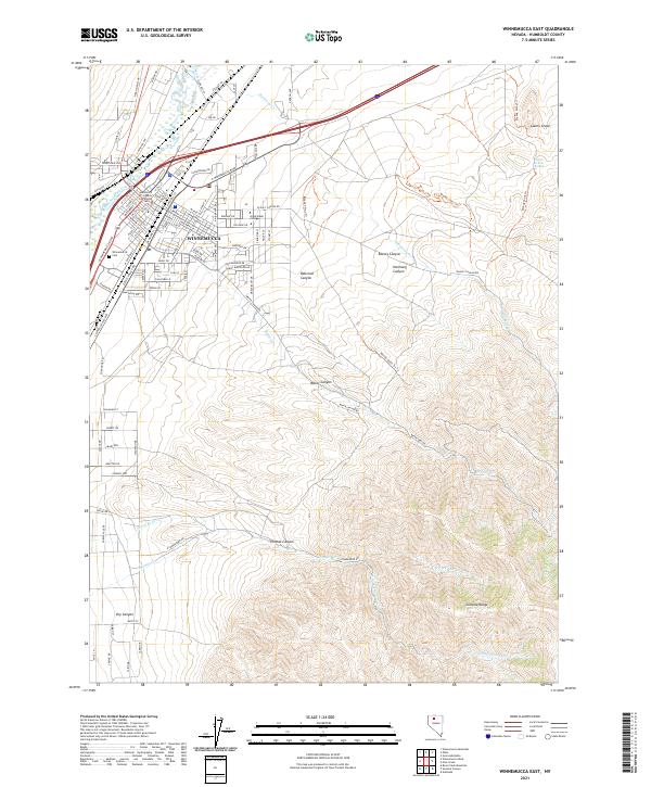
2021 Map of Winnemucca East
USGS Topo · Published 2021About this map
The high-desert city of Winnemucca serves as the focal point for this Nevada survey, showing the town's expansion toward the slopes of the Sonoma Range. The urban core is anchored by the Humboldt County Courthouse and Great Basin College, while the Winnemucca Cem sits on the western edge near the Humboldt River. The landscape transitions sharply from the street grid to the dramatic topography of the southeast, where a series of deep drainage cuts including Water Canyon, Thomas Canyon, and Railroad Canyon carve into the mountainside. To the northeast, the distinctive landform of Giants Grave and the nearby Giants Grave Spring provide important landmarks for local history and geography, while the network of mountain forks like N Fork Thomas Cr and S Fork Thomas Cr defines the local watershed.
Find a feature on this map
97 named features on this map. Tap any name to fly to it.
Don’t see what you’re looking for? This feature index may not catch every label — zoom into the map to look around manually.
Map Details
Editions of this 2021 Winnemucca East Map
This is the sole edition of this map. No revisions or reprints were ever made.
Other maps of this area

1882 · Paradise
USGS Topo · 1:250,000

1893 · Paradise
USGS Topo · 1:250,000

1932 · Sonoma Range
USGS Topo · 1:250,000

1939 · Sonoma Range
USGS Topo · 1:250,000

1955 · McDermitt
USGS Topo · 1:250,000

1955 · Winnemucca
USGS Topo · 1:250,000

1958 · Winnemucca
USGS Topo · 1:250,000

1958 · Winnemucca
USGS Topo · 1:62,500

1958 · Rose Creek
USGS Topo · 1:62,500

1959 · McDermitt
USGS Topo · 1:250,000