Loading...
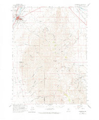
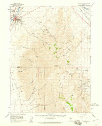
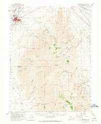
Loading map...1958 Map of Winnemucca
USGS Topo · Published 1965About this map
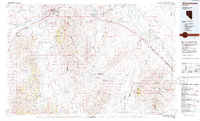
Winnemucca serves as the focal point of this late-1950s survey, situated along the Humboldt River where the Southern Pacific and Western Pacific railroads converge. The map illustrates the town’s infrastructure at the dawn of the Cold War, featuring the Winnemucca Air Force Station, a Courthouse, and the Radio Tower KWNA. East and south of the settlement, the Sonoma Range dominates the landscape, reaching its heights at Sonoma Peak. This mountainous terrain is deeply etched with canyons like Water Canyon Creek and Harmony Canyon.
Find a feature on this map
49 named features on this map. Tap any name to fly to it.
Don’t see what you’re looking for? This feature index may not catch every label — zoom into the map to look around manually.
Map Details
Date Portrayed1958
Date Published1965
PublisherU.S. Geological Survey
Map TypeTopographic
Scale1:62,500
Physical Dimensions18 x 21.8 inches
Editions of this 1958 Winnemucca Map
3 editions found
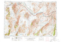
Historical Maps of Winnemucca Through Time
5 maps found


Featured Locations
Source Details
SourceU.S. Geological Survey
CopyrightPublic Domain