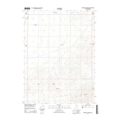
2015 Map of Winnemucca Mountain
USGS Topo · Published 2015About this map
Winnemucca Mountain dominates the southeastern quadrant of this Great Basin landscape, situated north of the city of the same name. This 2015 survey details a transition from the elevated peaks of the Krum Hills and Black Butte into the broad expanse of the Silver State Valley to the northwest. The terrain is marked by the distinct Public Land Survey System grid, which segments the territory into townships and ranges such as t37n r37e. Transportation across this arid region is facilitated by a few primary thoroughfares, notably Sand Pass Rd in the north and the winding W2 Ranch Rd which skirts the western foothills. The map provides a clear picture of the topographic relief in this part of Humboldt County, illustrating the relationship between the high desert summits and the drainage patterns leading into the valley floors.
Find a feature on this map
15 named features on this map. Tap any name to fly to it.
Don’t see what you’re looking for? This feature index may not catch every label — zoom into the map to look around manually.
Map Details
Editions of this 2015 Winnemucca Mountain Map
This is the sole edition of this map. No revisions or reprints were ever made.
Other maps of this area

1882 · Paradise
USGS Topo · 1:250,000

1893 · Paradise
USGS Topo · 1:250,000

1932 · Sonoma Range
USGS Topo · 1:250,000

1939 · Sonoma Range
USGS Topo · 1:250,000

1955 · McDermitt
USGS Topo · 1:250,000

1955 · Winnemucca
USGS Topo · 1:250,000

1958 · Winnemucca
USGS Topo · 1:250,000

1958 · Winnemucca
USGS Topo · 1:62,500

1958 · Rose Creek
USGS Topo · 1:62,500

1959 · McDermitt
USGS Topo · 1:250,000