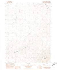
1982 Map of Winnemucca Mtn
USGS Topo · Published 1982About this map
The Krum Hills and the southern edge of the Santa Rosa Range dominate this desert landscape, revealing a history of exploration and extraction north of the Humboldt River. Water resources, critical in this arid environment, are marked by sites like Tobin Well and the CCC Well in the southern reaches of the Silver State Valley. Evidence of mining activity is concentrated in the southern uplands, where the Pansy Lee Mine is situated alongside various unnamed mines and prospects. This 1982 provisional survey reflects the area's transition into the late twentieth century, documenting the precise topography of Winnemucca Mountain and the transition through Sand Pass into the Bloody Run Hills.
Find a feature on this map
13 named features on this map. Tap any name to fly to it.
Don’t see what you’re looking for? This feature index may not catch every label — zoom into the map to look around manually.
Map Details
Editions of this 1982 Winnemucca Mtn Map
This is the sole edition of this map. No revisions or reprints were ever made.
Other maps of this area

1882 · Paradise
USGS Topo · 1:250,000

1893 · Paradise
USGS Topo · 1:250,000

1932 · Sonoma Range
USGS Topo · 1:250,000

1939 · Sonoma Range
USGS Topo · 1:250,000

1955 · McDermitt
USGS Topo · 1:250,000

1955 · Winnemucca
USGS Topo · 1:250,000

1958 · Winnemucca
USGS Topo · 1:250,000

1958 · Winnemucca
USGS Topo · 1:62,500

1958 · Rose Creek
USGS Topo · 1:62,500

1959 · McDermitt
USGS Topo · 1:250,000