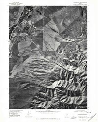
1975 Map of Winnemucca NW
USGS Topo · Published 1980About this map
The growing desert hub of Winnemucca is captured here in the mid-1970s, revealing the town's expansion across the high desert floor. This orthophotoquad provides a photographic perspective on the intersection of human development and the arid landscape of Humboldt County. While the northwest corner of the settlement shows a structured grid of streets and buildings, the southeastern portion of the map is dominated by the dramatic topography of the Sonoma Range foothills. Notable drainage patterns and geographical reliefs are visible along the steep descent of Water Canyon and the winding path of Thomas Creek, which cut through the dry terrain towards the Humboldt River valley. The contrast between the stark, light-colored alkali flats and the dark, folded ridges of the nearby mountains underscores the environmental constraints that have shaped this historic mining and transit stop.
Find a feature on this map
4 named features on this map. Tap any name to fly to it.
Don’t see what you’re looking for? This feature index may not catch every label — zoom into the map to look around manually.
Map Details
Editions of this 1975 Winnemucca NW Map
This is the sole edition of this map. No revisions or reprints were ever made.
Other maps of this area

1882 · Paradise
USGS Topo · 1:250,000

1893 · Paradise
USGS Topo · 1:250,000

1932 · Sonoma Range
USGS Topo · 1:250,000

1939 · Sonoma Range
USGS Topo · 1:250,000

1955 · McDermitt
USGS Topo · 1:250,000

1955 · Winnemucca
USGS Topo · 1:250,000

1958 · Winnemucca
USGS Topo · 1:250,000

1958 · Winnemucca
USGS Topo · 1:62,500

1958 · Rose Creek
USGS Topo · 1:62,500

1959 · McDermitt
USGS Topo · 1:250,000