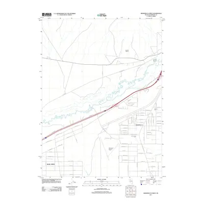
2011 Map of Winnemucca West
USGS Topo · Published 2011About this map
The Humboldt River winds through the high desert of Nevada in this 2011 survey, defining the northern edge of Winnemucca and its westward expansion. This map illustrates the intersection of ancient waterways and modern aviation, where the Winnemucca Municipal Airport and residential developments like the neighborhood around Aurora Ave sit atop the valley floor. To the west, the small settlement of Rose Creek serves as a waypoint along the transportation corridor that follows the river's historic path. Evidence of the region’s agricultural roots remains visible in the presence of established homesteads such as the Westmoreland Ranch and S Thomas Ranch. These properties, situated near drainage points like Clear Creek and Thomas Creek, highlight how local geography dictated the placement of ranches and infrastructure in a landscape framed by the looming Granite Ravine to the north.
Find a feature on this map
83 named features on this map. Tap any name to fly to it.
Don’t see what you’re looking for? This feature index may not catch every label — zoom into the map to look around manually.
Map Details
Editions of this 2011 Winnemucca West Map
This is the sole edition of this map. No revisions or reprints were ever made.
Other maps of this area

1882 · Paradise
USGS Topo · 1:250,000

1893 · Paradise
USGS Topo · 1:250,000

1932 · Sonoma Range
USGS Topo · 1:250,000

1939 · Sonoma Range
USGS Topo · 1:250,000

1955 · McDermitt
USGS Topo · 1:250,000

1955 · Winnemucca
USGS Topo · 1:250,000

1958 · Winnemucca
USGS Topo · 1:250,000

1958 · Winnemucca
USGS Topo · 1:62,500

1958 · Rose Creek
USGS Topo · 1:62,500

1959 · McDermitt
USGS Topo · 1:250,000