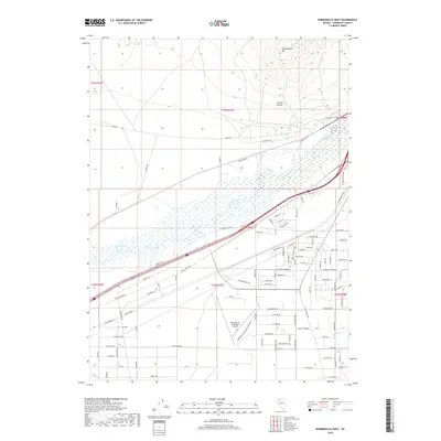
2018 Map of Winnemucca West
USGS Topo · Published 2018About this map
The Humboldt River winds through the Great Basin landscape west of the city, serving as the primary hydrological feature in this high-desert region. To the north, the elevation rises sharply toward Winnemucca Mtn and the steep cuts of Granite Ravine, which contrast with the flat alluvial plains occupied by the Winnemucca Municipal Airport. The infrastructure here is defined by a dense grid of residential and industrial streets expanding southward, alongside significant transit corridors like Jungo Rd and W Rose Creek Rd. Smaller seasonal drainages such as Clear Cr and Thomas Cr mark the southern reaches of the quadrangle. This 2018 survey illustrates the modern footprint of the region, where historical routes like Old Jungo Rd meet contemporary developments like Construction Way, reflecting the ongoing growth of this Nevada transportation hub.
Find a feature on this map
94 named features on this map. Tap any name to fly to it.
Don’t see what you’re looking for? This feature index may not catch every label — zoom into the map to look around manually.
Map Details
Editions of this 2018 Winnemucca West Map
This is the sole edition of this map. No revisions or reprints were ever made.
Other maps of this area

1882 · Paradise
USGS Topo · 1:250,000

1893 · Paradise
USGS Topo · 1:250,000

1932 · Sonoma Range
USGS Topo · 1:250,000

1939 · Sonoma Range
USGS Topo · 1:250,000

1955 · McDermitt
USGS Topo · 1:250,000

1955 · Winnemucca
USGS Topo · 1:250,000

1958 · Winnemucca
USGS Topo · 1:250,000

1958 · Winnemucca
USGS Topo · 1:62,500

1958 · Rose Creek
USGS Topo · 1:62,500

1959 · McDermitt
USGS Topo · 1:250,000