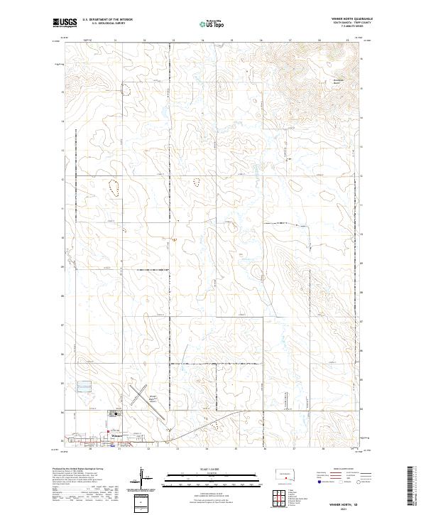
2021 Map of Winner North
USGS Topo · Published 2021About this map
Winner anchors the southwestern corner of this West River South Dakota landscape, serving as the seat of Tripp County. The town plan is clearly defined by its street grid, including W Tripp Ave, W 1st St, and Spruce St, centered around the Tripp County Courthouse. The surrounding prairie is bisected by a network of sectional roads and the meandering courses of Thunder Cr and Sand Cr. To the northeast, the terrain rises toward Bradleyon Butte, a prominent landmark in an otherwise gently undulating landscape. This 2021 survey also details essential infrastructure for the region, such as the Winner Regional Airport and the Winner City Cem, illustrating the modern layout of this rural agricultural hub.
Find a feature on this map
39 named features on this map. Tap any name to fly to it.
Don’t see what you’re looking for? This feature index may not catch every label — zoom into the map to look around manually.
Map Details
Editions of this 2021 Winner North Map
This is the sole edition of this map. No revisions or reprints were ever made.
Other maps of this area

1955 · Mitchell
USGS Topo · 1:250,000

1959 · Mitchell
USGS Topo · 1:250,000

1971 · Colome
USGS Topo · 1:24,000

1971 · Hamill
USGS Topo · 1:24,000

1971 · Rattlesnake Butte West
USGS Topo · 1:24,000

1982 · King Dam
USGS Topo · 1:25,000

1982 · Winner North
USGS Topo · 1:25,000

1982 · Winner South
USGS Topo · 1:25,000
1982 · Miller Hill
USGS Topo · 1:25,000
1982 · Ideal
USGS Topo · 1:24,000