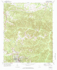
1969 Map of Winnsboro
USGS Topo · Published 1973About this map
The town of Winnsboro serves as the focal point for this Fairfield County study, which highlights a landscape shaped by the Southern railroad and a dense network of rural landmarks. The railway corridor connects the northern settlement of White Oak to the smaller siding at Adger, following the ridge lines between the numerous creek systems that define the topography. A high concentration of community centers is evident through the inclusion of Weeping Mary Ch, St Pauls Ch, and Mt Olivet Ch, providing valuable points of interest for genealogists tracing family histories in the South Carolina Piedmont.
Find a feature on this map
30 named features on this map. Tap any name to fly to it.
Don’t see what you’re looking for? This feature index may not catch every label — zoom into the map to look around manually.
Map Details
Editions of this 1969 Winnsboro Map
2 editions found
Other maps of this area

1904 · Columbia
USGS Topo · 1:125,000

1941 · Spartanburg
USGS Topo · 1:250,000

1942 · Camden
USGS Topo · 1:125,000

1953 · Spartanburg
USGS Topo · 1:250,000

1960 · Spartanburg
USGS Topo · 1:250,000

1963 · Spartanburg
USGS Topo · 1:250,000

1964 · Spartanburg
USGS Topo · 1:250,000

1968 · Blackstock
USGS Topo · 1:24,000
1969 · Great Falls
USGS Topo · 1:24,000

1969 · Lebanon
USGS Topo · 1:24,000