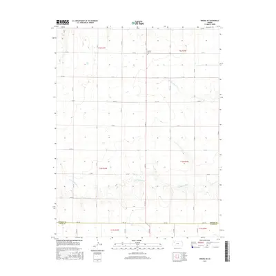
2015 Map of Winona NE
USGS Topo · Published 2015About this map
The N Fork Saline River and S Fork Saline River define the undulating High Plains landscape of Northwest Kansas in this 2015 study. Spanning the boundary between Thomas County and Logan County, the map captures a vast agricultural and ranching territory structured by an extensive grid of section-line roads, including Co Rd I, Co Rd H, and Co Rd 19. This network of rural transit underscores the isolation and meticulous organization of the western Kansas prairie. One of the few designated landmarks of local historical significance is the Summers Township Cem, located in the northern reaches of the quadrangle. In the south, the passage of Fort Fox road provides a longitudinal axis through the river-carved terrain, while the river forks themselves exhibit a complex drainage pattern that has shaped the region's land use for generations.
Find a feature on this map
32 named features on this map. Tap any name to fly to it.
Don’t see what you’re looking for? This feature index may not catch every label — zoom into the map to look around manually.
Map Details
Editions of this 2015 Winona NE Map
This is the sole edition of this map. No revisions or reprints were ever made.
Other maps of this area

1943 · Colby
USGS Topo · 1:62,500

1954 · Goodland
USGS Topo · 1:250,000

1956 · Goodland
USGS Topo · 1:250,000

1957 · Goodland
USGS Topo · 1:250,000

1967 · Colby SE
USGS Topo · 1:24,000

1967 · Colby SW
USGS Topo · 1:24,000

1972 · Monument
USGS Topo · 1:24,000
1972 · Winona
USGS Topo · 1:24,000

1972 · Winona NE
USGS Topo · 1:24,000
1972 · Winona NW
USGS Topo · 1:24,000