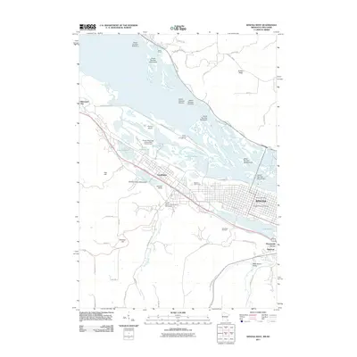
2011 Map of Winona West
USGS Topo · Published 2011About this map
The Mississippi River dominates the northern reaches of this map, its braided channels weaving around numerous numbered islands like Island Number Sixty-three and Island Number Sixty-five. On the southern bank, the urban landscape of Winona and Goodview is anchored by institutional landmarks, including Winona State University and Saint Mary's University of Minnesota. The transition from the river bottomlands of Prairie Island to the dramatic bluffs is marked by steep elevation changes at Stockton Hill and Sugarloaf, which overlook the valley floor.
Find a feature on this map
68 named features on this map. Tap any name to fly to it.
Don’t see what you’re looking for? This feature index may not catch every label — zoom into the map to look around manually.
Map Details
Editions of this 2011 Winona West Map
This is the sole edition of this map. No revisions or reprints were ever made.
Other maps of this area

1929 · Fountain City
USGS Topo · 1:62,500

1932 · Cochrane
USGS Topo · 1:62,500

1934 · Winona
USGS Topo · 1:62,500

1934 · Cochrane
USGS Topo · 1:62,500

1937 · Winona
USGS Topo · 1:62,500

1937 · Cochrane
USGS Topo · 1:62,500

1953 · Eau Claire
USGS Topo · 1:250,000

1954 · Lewiston
USGS Topo · 1:62,500

1958 · Eau Claire
USGS Topo · 1:250,000

1958 · Houston
USGS Topo · 1:62,500