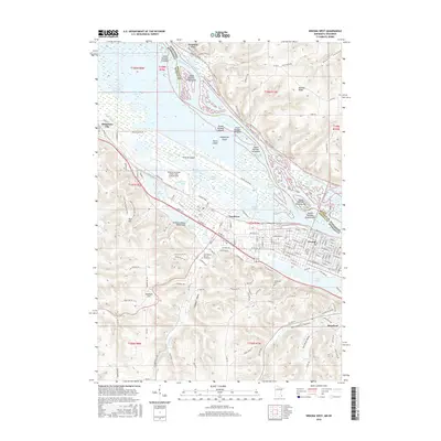
2016 Map of Winona West
USGS Topo · Published 2016About this map
Winona and its surrounding river valley are defined by a complex network of backwaters and islands within the Mississippi River. This 2016 survey illustrates the dense urban corridor stretching from Goodview toward the historic center of the city, flanked by the steep bluffs of Stockton Hill and Buffalo Ridge. The landscape reveals a sophisticated mix of academic and aviation infrastructure, including the sprawling campuses of Saint Marys Univ of Minnesota and Winona State Univ, alongside the Winona Municipal Airport-Max Conrad Field. A intricate series of side channels like Indian Channel and Blackbird Slough weave through numerous numbered islands, while the distinctive Sugarloaf landmark stands watch over the southern valley. The geography here is a study in how the city has balanced its expansion across the flats of Prairie Island against the restrictive topography of the Gilmore Valley and the fluctuating waters of Pool 5A.
Find a feature on this map
139 named features on this map. Tap any name to fly to it.
Don’t see what you’re looking for? This feature index may not catch every label — zoom into the map to look around manually.
Map Details
Editions of this 2016 Winona West Map
This is the sole edition of this map. No revisions or reprints were ever made.
Other maps of this area

1929 · Fountain City
USGS Topo · 1:62,500

1932 · Cochrane
USGS Topo · 1:62,500

1934 · Winona
USGS Topo · 1:62,500

1934 · Cochrane
USGS Topo · 1:62,500

1937 · Winona
USGS Topo · 1:62,500

1937 · Cochrane
USGS Topo · 1:62,500

1953 · Eau Claire
USGS Topo · 1:250,000

1954 · Lewiston
USGS Topo · 1:62,500

1958 · Eau Claire
USGS Topo · 1:250,000

1958 · Houston
USGS Topo · 1:62,500