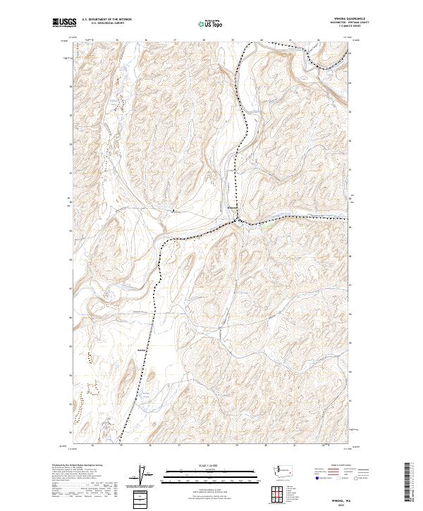
2023 Map of Winona
USGS Topo · Published 2023About this map
Winona sits at a geographic crossroads in Whitman County, where the Palouse River meets the valley of Rebel Flat Creek. This landscape is defined by the unique drainage patterns of the Palouse, characterized by deeply etched coulees and draws such as Texas Draw and Mason Draw that cut through the high plateau. The map details a rural infrastructure of named roads that often follow these natural contours, including Chicken Rd and the Benge Winona Rd. Local history is anchored by the Winona Cem and the small settlement of Sutton to the south. Further south, Sutton Pond and Dynamite Jack Rd highlight the localized names and features that define this agricultural region. The intermittent water features and ponds, including Johnson Lake, illustrate the complex hydrology of the eastern Washington scablands.
Find a feature on this map
28 named features on this map. Tap any name to fly to it.
Don’t see what you’re looking for? This feature index may not catch every label — zoom into the map to look around manually.
Map Details
Editions of this 2023 Winona Map
This is the sole edition of this map. No revisions or reprints were ever made.
Other maps of this area

1950 · La Crosse
USGS Topo · 1:62,500

1950 · Endicott
USGS Topo · 1:62,500

1952 · La Crosse
USGS Topo · 1:62,500

1955 · Pullman
USGS Topo · 1:250,000

1955 · Spokane
USGS Topo · 1:250,000

1958 · Spokane
USGS Topo · 1:250,000

1958 · Pullman
USGS Topo · 1:250,000

1964 · Texas Lake
USGS Topo · 1:24,000

1964 · Revere
USGS Topo · 1:24,000

1964 · Ewan
USGS Topo · 1:24,000