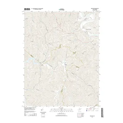
2014 Map of Winslow
USGS Topo · Published 2014About this map
Guyandotte River flows through the northeast corner of this Cabell County landscape, where the settlement of Owens Crossing sits near the base of the Mayapple Mts. The topography is defined by narrow ridges and winding hollows, including Doss Hill and the waters of Heath Cr and Merritt Cr. This 2014 survey documents a region where community identity is rooted in the drainages of Beech Fork and Raccoon Creek, with several small settlements such as Winslow and Bowen connected by a network of county roads. For local historians and genealogists, the map reveals the locations of family burial grounds and community landmarks like Floral Oaks Cem, Morrison Cem, and Wallace Cem. The presence of Beech Fork Lake in the west signifies a shift in the local hydrology, while the borders of Wayne Co and Cabell Co weave through the central hills.
Find a feature on this map
91 named features on this map. Tap any name to fly to it.
Don’t see what you’re looking for? This feature index may not catch every label — zoom into the map to look around manually.
Map Details
Editions of this 2014 Winslow Map
This is the sole edition of this map. No revisions or reprints were ever made.
Other maps of this area

1892 · Huntington
USGS Topo · 1:125,000

1898 · Huntington
USGS Topo · 1:125,000

1901 · Guyandot
USGS Topo · 1:62,500

1902 · Guyandot
USGS Topo · 1:62,500

1902 · Milton
USGS Topo · 1:62,500

1902 · Midkiff
USGS Topo · 1:62,500

1907 · Midkiff
USGS Topo · 1:62,500

1909 · Wayne
USGS Topo · 1:62,500

1909 · Midkiff
USGS Topo · 1:62,500

1931 · Wayne
USGS Topo · 1:62,500