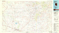
1982 Map of Winslow
USGS Topo · Published 1983About this map
Winslow sits at the southern edge of this high desert landscape, serving as a vital transportation hub along the Atchison Topeka and Santa Fe railroad. The geography is defined by vast mesas and seasonal drainages, where the Little Colorado River winds through the Painted Desert toward the northwest. North of the Toltec Divide, the map reveals the complex boundaries and overlapping territories of the Navajo Indian Reservation and Hopi Indian Reservation, featuring isolated outposts like Leupp and Indian Wells. The terrain is punctuated by distinctive volcanic remnants and landforms, from the towering Hop Buttes to the oddly named Rotten Bananas Butte. This 1982 survey illustrates a landscape of scattered water sources, where remote locations like Joseph City Spring and Cedar Springs provided critical reliability in an arid environment increasingly marked by modern infrastructure like the Municipal Airport and various radio facilities.
Find a feature on this map
117 named features on this map. Tap any name to fly to it.
Don’t see what you’re looking for? This feature index may not catch every label — zoom into the map to look around manually.
Map Details
Editions of this 1982 Winslow Map
2 editions found
Other maps of this area

1883 · Tusayan
USGS Topo · 1:250,000

1886 · St Johns
USGS Topo · 1:250,000

1886 · Tusayan
USGS Topo · 1:250,000

1886 · Fort Defiance
USGS Topo · 1:250,000

1886 · San Francisco Mtns
USGS Topo · 1:250,000

1886 · Holbrook
USGS Topo · 1:250,000

1887 · Verde
USGS Topo · 1:250,000

1891 · San Francisco Mtns
USGS Topo · 1:250,000

1892 · Verde
USGS Topo · 1:250,000

1892 · Fort Defiance
USGS Topo · 1:250,000