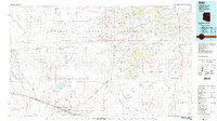
1982 Map of Winslow
USGS Topo · Published 1983About this map
The Little Colorado River carves a path through this high desert landscape, serving as a primary corridor for the Atchison Topeka and Santa Fe railroad and the growth of Winslow. At the start of the 1980s, the area reflects a mix of transit infrastructure and ancient landforms. To the north, the Navajo Indian Reservation contains striking volcanic and geological features like Montezumas Chair, Haystack Butte, and the colorful expanse of the Painted Desert.
Find a feature on this map
100 named features on this map. Tap any name to fly to it.
Don’t see what you’re looking for? This feature index may not catch every label — zoom into the map to look around manually.
Map Details
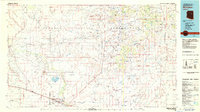
Editions of this 1982 Winslow Map
2 editions found
Other maps of this area

1883 · Tusayan
USGS Topo · 1:250,000

1886 · St Johns
USGS Topo · 1:250,000

1886 · Tusayan
USGS Topo · 1:250,000

1886 · Fort Defiance
USGS Topo · 1:250,000

1886 · San Francisco Mtns
USGS Topo · 1:250,000

1886 · Holbrook
USGS Topo · 1:250,000

1887 · Verde
USGS Topo · 1:250,000

1891 · San Francisco Mtns
USGS Topo · 1:250,000

1892 · Verde
USGS Topo · 1:250,000

1892 · Fort Defiance
USGS Topo · 1:250,000