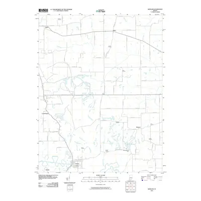
2010 Map of Winslow
USGS Topo · Published 2010About this map
Winslow sits at the southern edge of this landscape, its street grid bounded by the Patoka River and the northern reach of Ayrshire. The region is defined by a dense network of watercourses, including Stone Coe Creek, Lick Creek, and the many-fingered White Oak Lake held by the White Oak Lake Dam. Small agrarian settlements like Algiers, Cato, and Alford are connected by a precise grid of county roads, such as Forty Dollar Rd and the Cato and Algiers Rd.
Find a feature on this map
70 named features on this map. Tap any name to fly to it.
Don’t see what you’re looking for? This feature index may not catch every label — zoom into the map to look around manually.
Map Details
Editions of this 2010 Winslow Map
This is the sole edition of this map. No revisions or reprints were ever made.
Other maps of this area

1902 · Ditney
USGS Topo · 1:125,000

1903 · Velpen
USGS Topo · 1:62,500

1903 · Petersburg
USGS Topo · 1:62,500

1944 · Glendale
USGS Topo · 1:24,000

1944 · Monroe City
USGS Topo · 1:24,000

1945 · Sandy Hook
USGS Topo · 1:24,000

1956 · Vincennes
USGS Topo · 1:250,000

1957 · Vincennes
USGS Topo · 1:250,000

1958 · Vincennes
USGS Topo · 1:250,000
1958 · Monroe City
USGS Topo · 1:24,000