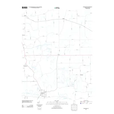
2013 Map of Winslow
USGS Topo · Published 2013About this map
Winslow anchor this southern Indiana landscape where the Patoka River meanders across the bottom of the quadrangle. This 2013 survey reveals a pattern of rural settlements including Alford, Algiers, and Cato, connected by a grid of county roads that cut through the drainage basins of Mud Cr and Flat Cr. The area around Whiteoak and White Oak Lake shows a transition toward more broken terrain near the river valley.
Find a feature on this map
72 named features on this map. Tap any name to fly to it.
Don’t see what you’re looking for? This feature index may not catch every label — zoom into the map to look around manually.
Map Details
Editions of this 2013 Winslow Map
This is the sole edition of this map. No revisions or reprints were ever made.
Other maps of this area

1902 · Ditney
USGS Topo · 1:125,000

1903 · Velpen
USGS Topo · 1:62,500

1903 · Petersburg
USGS Topo · 1:62,500

1944 · Glendale
USGS Topo · 1:24,000

1944 · Monroe City
USGS Topo · 1:24,000

1945 · Sandy Hook
USGS Topo · 1:24,000

1956 · Vincennes
USGS Topo · 1:250,000

1957 · Vincennes
USGS Topo · 1:250,000

1958 · Vincennes
USGS Topo · 1:250,000
1958 · Monroe City
USGS Topo · 1:24,000