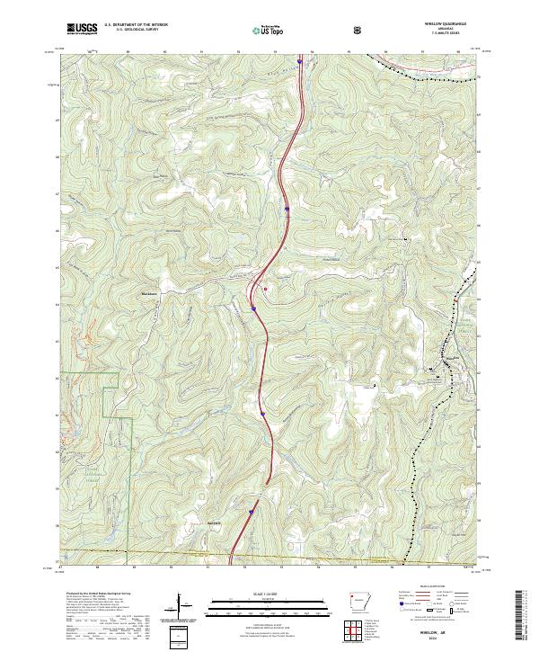
2024 Map of Winslow
USGS Topo · Published 2024About this map
Winslow occupies a high point on the Boston Mountains divide where the A & M RR and the West Fork White River meet. This contemporary survey details the rugged topography of the Ozark National Forest, defined by a complex network of hollows including Honey Hollow, Porter Hollow, and Gafield Hollow. The map tracks the interstate and local roads that follow these natural contours, illustrating how geography continues to dictate movement in this part of Washington County.
Find a feature on this map
101 named features on this map. Tap any name to fly to it.
Don’t see what you’re looking for? This feature index may not catch every label — zoom into the map to look around manually.
Map Details
Editions of this 2024 Winslow Map
This is the sole edition of this map. No revisions or reprints were ever made.
Other maps of this area

1898 · Winslow #4
USGS Topo · 1:62,500

1898 · Winslow #3
USGS Topo · 1:62,500

1898 · Winslow
USGS Topo · 1:125,000

1901 · Winslow
USGS Topo · 1:125,000

1946 · Fort Smith
USGS Topo · 1:250,000

1965 · Fort Smith
USGS Topo · 1:250,000

1967 · Fort Smith
USGS Topo · 1:250,000
1969 · Fern
USGS Topo · 1:24,000
1969 · Mountainburg
USGS Topo · 1:24,000
1970 · Rudy NE
USGS Topo · 1:24,000