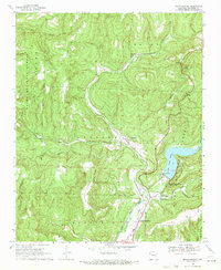
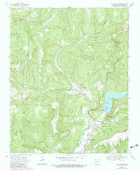
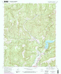
1969 Map of Mountainburg
USGS Topo · Published 1971About this map
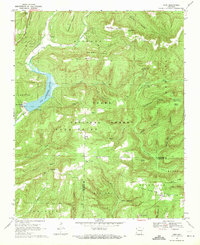
Lake Fort Smith dominates the eastern edge of this landscape, its waters contained by the dam near the Fort Smith Filtration Plant. The surrounding Crawford County terrain is defined by the steep ridges of the Ozark National Forest, including Ben Doodle Ridge and Meadow Mountain. The St Louis-San Francisco railroad winds through the valley of Clear Creek, connecting the small settlements of Schaberg and Chester with the community of Mountainburg to the south.
Find a feature on this map
36 named features on this map. Tap any name to fly to it.
Don’t see what you’re looking for? This feature index may not catch every label — zoom into the map to look around manually.
Map Details
Editions of this 1969 Mountainburg Map
3 editions found
Other maps of this area

1898 · Winslow #4
USGS Topo · 1:62,500

1898 · Winslow #3
USGS Topo · 1:62,500

1898 · Winslow
USGS Topo · 1:125,000

1901 · Winslow
USGS Topo · 1:125,000

1946 · Fort Smith
USGS Topo · 1:250,000

1965 · Fort Smith
USGS Topo · 1:250,000

1967 · Fort Smith
USGS Topo · 1:250,000
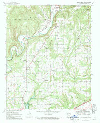
1969 · Mountainburg SW
USGS Topo · 1:24,000
1969 · Fern
USGS Topo · 1:24,000
1969 · Rudy
USGS Topo · 1:24,000