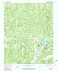
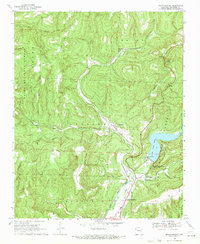
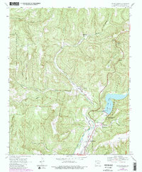
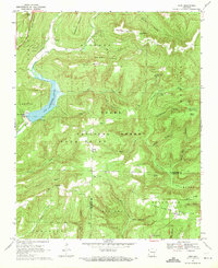
1969 Map of Mountainburg
USGS Topo · Published 1983About this map
Frog Bayou carves a deep path through Crawford County, defining the corridor for both the St Louis-San Francisco railroad and U.S. Highway 71. This 1969 survey, photorevised in the early 1980s, captures the northern reaches of Lake Fort Smith and its namesake State Park, a vital water source evidenced by the Fort Smith Filtration Plant and nearby Gaging Station.
Find a feature on this map
40 named features on this map. Tap any name to fly to it.
Don’t see what you’re looking for? This feature index may not catch every label — zoom into the map to look around manually.
Map Details
Editions of this 1969 Mountainburg Map
3 editions found
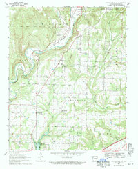
Other maps of this area

1898 · Winslow #4
USGS Topo · 1:62,500

1898 · Winslow #3
USGS Topo · 1:62,500

1898 · Winslow
USGS Topo · 1:125,000

1901 · Winslow
USGS Topo · 1:125,000

1946 · Fort Smith
USGS Topo · 1:250,000

1965 · Fort Smith
USGS Topo · 1:250,000

1967 · Fort Smith
USGS Topo · 1:250,000
1969 · Mountainburg SW
USGS Topo · 1:24,000
1969 · Fern
USGS Topo · 1:24,000
1969 · Rudy
USGS Topo · 1:24,000