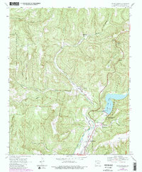
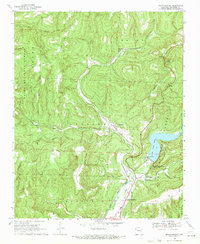
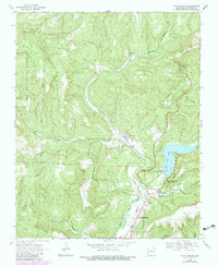
1969 Map of Mountainburg
USGS Topo · Published 1983About this map
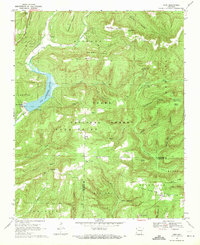
Frog Bayou carves a deep valley through the Crawford County landscape, dictating the settlement patterns of Mountainburg and Chester as they follow the corridor of the Burlington Northern railroad. This survey captures a moment when the transportation spine of the region relied on the narrow path between Meadow Mountain and the Ozark National Forest boundary. Genealogical interest is centered on several community landmarks, including the Basham Memorial Cem and Hillcrest Cem near the southern bend, as well as the isolated Freedom Ch in the western hills. The map highlights the early infrastructure of Lake Fort Smith, including the Gaging Station and the Fort Smith Filtration Plant, which utilized the natural drainage of Clear Creek and Riley Creek. Small enclaves like Schaberg and the scenic Artist Point are shown at their 1960s extent, providing a clear record of local geography before later developments.
Find a feature on this map
38 named features on this map. Tap any name to fly to it.
Don’t see what you’re looking for? This feature index may not catch every label — zoom into the map to look around manually.
Map Details
Editions of this 1969 Mountainburg Map
3 editions found
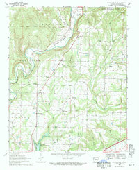
Other maps of this area

1898 · Winslow #4
USGS Topo · 1:62,500

1898 · Winslow #3
USGS Topo · 1:62,500

1898 · Winslow
USGS Topo · 1:125,000

1901 · Winslow
USGS Topo · 1:125,000

1946 · Fort Smith
USGS Topo · 1:250,000

1965 · Fort Smith
USGS Topo · 1:250,000

1967 · Fort Smith
USGS Topo · 1:250,000
1969 · Mountainburg SW
USGS Topo · 1:24,000
1969 · Fern
USGS Topo · 1:24,000
1969 · Rudy
USGS Topo · 1:24,000