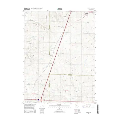
2014 Map of Winston
USGS Topo · Published 2014About this map
Three Missouri counties converge on this landscape, with DeKalb, Daviess, and Caldwell jurisdictions meeting in a complex patchwork of rural road grids and drainage basins. The area is defined by the high ground between water systems, with Grindstone Creek and Rice Creek flowing north while Brushy Creek and Long Branch trend toward the south and east. A significant number of small burial grounds, such as Kenney Cemetery and Christian Chapel Cemetery, are preserved among the farmsteads, offering valuable clues for genealogical research in this agrarian corridor.
Find a feature on this map
59 named features on this map. Tap any name to fly to it.
Don’t see what you’re looking for? This feature index may not catch every label — zoom into the map to look around manually.
Map Details
Editions of this 2014 Winston Map
This is the sole edition of this map. No revisions or reprints were ever made.
Other maps of this area

1923 · Maysville
USGS Topo · 1:62,500

1924 · Polo
USGS Topo · 1:62,500

1924 · Winston
USGS Topo · 1:62,500

1925 · Plattsburg
USGS Topo · 1:62,500

1925 · Maysville
USGS Topo · 1:62,500

1950 · Kansas City
USGS Topo · 1:250,000

1954 · Kansas City
USGS Topo · 1:250,000

1956 · Kansas City
USGS Topo · 1:250,000

1960 · Kansas City
USGS Topo · 1:250,000
1983 · Maysville
USGS Topo · 1:24,000