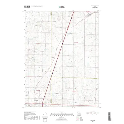
2017 Map of Winston
USGS Topo · Published 2017About this map
The city of Cameron anchors the southwest corner of this Northwest Missouri landscape, where the borders of DeKalb, Daviess, and Caldwell counties converge. The terrain is defined by a dense network of tributaries including Grindstone Cr and Rice Cr, reflecting a rural topography focused on agriculture and small-town connections. Farther north, the village of Winston and the settlement of Mabel represent the persistent residential nodes of the region, linked by a grid of named roads like SE Santa Rosa Rd and Sunset Ave.
Find a feature on this map
86 named features on this map. Tap any name to fly to it.
Don’t see what you’re looking for? This feature index may not catch every label — zoom into the map to look around manually.
Map Details
Editions of this 2017 Winston Map
This is the sole edition of this map. No revisions or reprints were ever made.
Other maps of this area

1923 · Maysville
USGS Topo · 1:62,500

1924 · Polo
USGS Topo · 1:62,500

1924 · Winston
USGS Topo · 1:62,500

1925 · Plattsburg
USGS Topo · 1:62,500

1925 · Maysville
USGS Topo · 1:62,500

1950 · Kansas City
USGS Topo · 1:250,000

1954 · Kansas City
USGS Topo · 1:250,000

1956 · Kansas City
USGS Topo · 1:250,000

1960 · Kansas City
USGS Topo · 1:250,000
1983 · Maysville
USGS Topo · 1:24,000