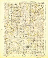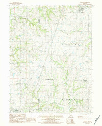
1984 Map of Winston
USGS Topo · Published 1984About this map
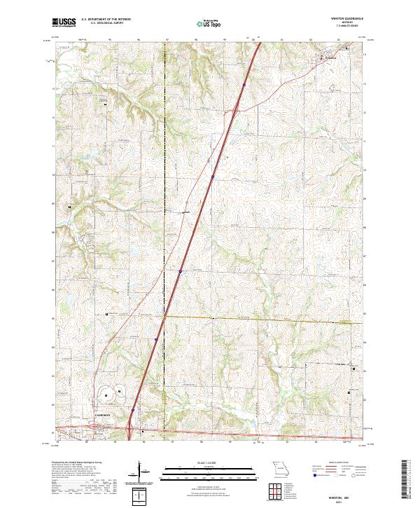
The Grand River meanders across the southern portion of this Missouri landscape, marking the intersection of Daviess, DeKalb, and Caldwell counties. The settlement of Winston serves as a primary hub in the north, while the smaller community of Mabel sits further south near several Radio Towers. This 1980s field check documents a largely agricultural region defined by its creek systems, including Grindstone Creek, Rice Creek, and Wamsley Creek, which feed into the larger river basin. Genealogists will find a high density of burial sites across these townships, with several family-named or church-affiliated plots such as Blake Cem, Christian Chapel Cem, and Wamsley Cem. Transportation is anchored by the Burlington Northern railroad corridor, which skirts the southern edge of the quadrangle near the Cameron Trailer Park.
Find a feature on this map
27 named features on this map. Tap any name to fly to it.
Don’t see what you’re looking for? This feature index may not catch every label — zoom into the map to look around manually.
Map Details
Editions of this 1984 Winston Map
This is the sole edition of this map. No revisions or reprints were ever made.
Historical Maps of Cameron Through Time
6 maps found