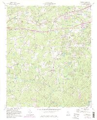
1973 Map of Winston
USGS Topo · Published 1983About this map
Winston and Bill Arp anchor this topographic study of Douglas County during a period of shifting infrastructure and suburban growth. The Southern Railway corridors and historical roads like Kings Highway define the transit patterns between the established town centers and the Chattahoochee River to the southeast. Local life is centered around a network of country churches and schools, including Winston Sch, Old Mtn Top Ch, and New Bethel Ch. The landscape is deeply etched by a complex drainage system where Mobley Creek and Cedar Creek feed into the Dog River. Evidence of early industrial and communal activity persists in names like Foots Mill and the Quarry near Douglasville, while newer features like the Water Tank and several pipelines signal the modernization of the Georgia Piedmont.
Find a feature on this map
75 named features on this map. Tap any name to fly to it.
Don’t see what you’re looking for? This feature index may not catch every label — zoom into the map to look around manually.
Map Details
Editions of this 1973 Winston Map
3 editions found
Other maps of this area

1891 · Marietta
USGS Topo · 1:125,000

1895 · Marietta
USGS Topo · 1:125,000

1897 · Marietta
USGS Topo · 1:125,000

1901 · Marietta
USGS Topo · 1:125,000

1953 · Atlanta
USGS Topo · 1:250,000

1954 · Palmetto
USGS Topo · 1:24,000

1954 · Campbellton
USGS Topo · 1:24,000

1954 · Austell
USGS Topo · 1:24,000

1957 · Atlanta
USGS Topo · 1:250,000

1958 · Rico
USGS Topo · 1:24,000