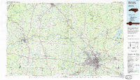
1984 Map of Winston-Salem
USGS Topo · Published 1985About this map
The Yadkin River defines the heart of this North Carolina Piedmont landscape, winding between the Blue Ridge and the Brushy Mountains. By the mid-1980s, the urban footprint of Winston-Salem had expanded significantly, stretching toward Kernersville and Walkertown. The map illustrates the industrial and transportation corridors of the era, anchored by the Southern Railway and the Norfolk and Western Railway lines that linked rural agricultural centers like Yadkinville, Dobson, and Mount Airy to the larger city.
Find a feature on this map
149 named features on this map. Tap any name to fly to it.
Don’t see what you’re looking for? This feature index may not catch every label — zoom into the map to look around manually.
Map Details
Editions of this 1984 Winston-Salem Map
2 editions found
Other maps of this area

1889 · Hillsville
USGS Topo · 1:125,000

1889 · Wytheville
USGS Topo · 1:125,000

1889 · Wilkesboro
USGS Topo · 1:125,000

1891 · Wilkesboro
USGS Topo · 1:125,000

1891 · Yadkinville
USGS Topo · 1:125,000

1892 · Hillsville
USGS Topo · 1:125,000

1892 · Wytheville
USGS Topo · 1:125,000

1893 · Statesville
USGS Topo · 1:125,000

1893 · Yadkinville
USGS Topo · 1:125,000

1895 · Hickory
USGS Topo · 1:125,000