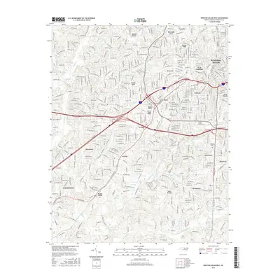
2016 Map of Winston-Salem West
USGS Topo · Published 2016About this map
The western suburbs and industrial corridors of Winston-Salem define this 2016 survey, showcasing a landscape of established neighborhoods and modern educational institutions. This area is characterized by a mix of historic residential zones such as Ardmore and Buena Vista alongside sprawling developments like Clemmons. Notable landmarks include the Jefferson Elementary school and the Forsyth Technical Community Coll, which serve as anchors for the local community. The terrain is divided by a complex drainage system, where Silas Cr and Salem Creek wind through wooded parklands.
Find a feature on this map
61 named features on this map. Tap any name to fly to it.
Don’t see what you’re looking for? This feature index may not catch every label — zoom into the map to look around manually.
Map Details
Editions of this 2016 Winston-Salem West Map
This is the sole edition of this map. No revisions or reprints were ever made.
Other maps of this area

1949 · Eller
USGS Topo · 1:24,000

1950 · Winston-Salem West
USGS Topo · 1:24,000

1950 · Winston-Salem East
USGS Topo · 1:24,000

1951 · Winston-Salem West
USGS Topo · 1:24,000

1951 · Winston-Salem East
USGS Topo · 1:24,000

1951 · Rural Hall
USGS Topo · 1:24,000

1951 · Walkertown
USGS Topo · 1:24,000

1953 · Charlotte
USGS Topo · 1:250,000

1953 · Winston-Salem
USGS Topo · 1:250,000

1954 · Charlotte
USGS Topo · 1:250,000