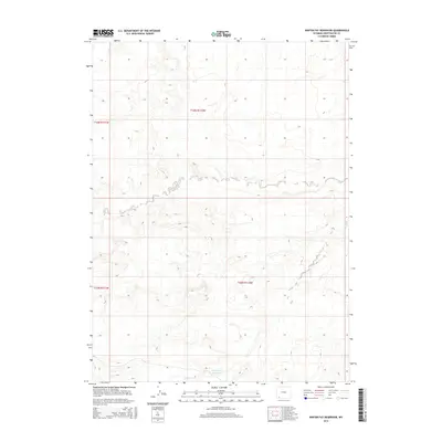
2015 Map of Winter Fat Reservoir
USGS Topo · Published 2015About this map
Winter Fat Reservoir lies in the high desert landscape of Sweetwater County, serving as a primary water source in this arid region of southwestern Wyoming. The area is defined by the Public Land Survey System grids of t16n r111w, t16n r110w, t15n r111w, and t15n r110w. This 2015 USGS survey documents the topographic contours and remote drainage patterns that characterize the basin. The map illustrates a largely uninhabited terrain where the management of water resources like Winter Fat Reservoir is essential for land use and ranching operations. Researchers can examine the relief and drainage systems that dictate the movement of seasonal runoff across these vast township sections.
Find a feature on this map
5 named features on this map. Tap any name to fly to it.
Don’t see what you’re looking for? This feature index may not catch every label — zoom into the map to look around manually.
Map Details
Editions of this 2015 Winter Fat Reservoir Map
This is the sole edition of this map. No revisions or reprints were ever made.
Other maps of this area

1954 · Rock Springs
USGS Topo · 1:250,000

1957 · Mc Kinnon Junction
USGS Topo · 1:62,500

1958 · Rock Springs
USGS Topo · 1:250,000

1962 · Rock Springs
USGS Topo · 1:250,000

1964 · Antelope Knoll NE
USGS Topo · 1:24,000

1964 · Black Spring Reservoir
USGS Topo · 1:24,000

1964 · Antelope Knoll
USGS Topo · 1:24,000

1964 · Winter Fat Reservoir
USGS Topo · 1:24,000
1964 · Horse Ranch
USGS Topo · 1:24,000
1964 · Needle Reservoir
USGS Topo · 1:24,000