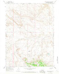
1964 Map of Needle Reservoir
USGS Topo · Published 1968About this map
Antelope Knoll dominates the northern high ground of this Sweetwater County landscape, which was mapped in the early 1960s to document the arid drainage systems and water management of the high plains. The topography is defined by intricate erosional features and seasonal watercourses such as Tin Can Draw, Cattail Draw, and Big Dry Creek. Settlement is nearly nonexistent, represented only by the isolated Staley Corral in the southern reaches. The reliance on managed water in this environment is evident through the series of small impoundments scattered across the terrain, including Needle Reservoir, Big Hollow Reservoir, and Badlands Reservoir. A network of simple jeep trails provides the only transit through this section of the Wyoming desert, connecting these remote watering points and livestock sites.
Find a feature on this map
12 named features on this map. Tap any name to fly to it.
Don’t see what you’re looking for? This feature index may not catch every label — zoom into the map to look around manually.
Map Details
Editions of this 1964 Needle Reservoir Map
This is the sole edition of this map. No revisions or reprints were ever made.
Other maps of this area

1954 · Ogden
USGS Topo · 1:250,000

1954 · Rock Springs
USGS Topo · 1:250,000

1958 · Ogden
USGS Topo · 1:250,000

1958 · Rock Springs
USGS Topo · 1:250,000

1960 · Ogden
USGS Topo · 1:250,000

1962 · Rock Springs
USGS Topo · 1:250,000

1964 · Butcher Knife Draw
USGS Topo · 1:24,000

1964 · Soap Holes Reservoir
USGS Topo · 1:24,000

1964 · Antelope Knoll NE
USGS Topo · 1:24,000

1964 · Black Spring Reservoir
USGS Topo · 1:24,000