
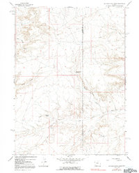
1964 Map of Butcher Knife Draw
USGS Topo · Published 1967About this map
Butcher Knife Spring and Shurtliff Spring serve as critical water points in this arid stretch of the High Plains during the mid-1960s. The landscape is defined by its drainage systems, featuring the deeply incised Butcher Knife Draw and Tin Can Draw which carve through the high plateaus. This era shows an landscape transitioning from traditional ranching toward energy development, evidenced by the appearance of scattered Gas Wells and several Drill Holes.
Find a feature on this map
16 named features on this map. Tap any name to fly to it.
Don’t see what you’re looking for? This feature index may not catch every label — zoom into the map to look around manually.
Map Details
Editions of this 1964 Butcher Knife Draw Map
2 editions found
Other maps of this area

1954 · Ogden
USGS Topo · 1:250,000

1954 · Rock Springs
USGS Topo · 1:250,000

1958 · Ogden
USGS Topo · 1:250,000

1958 · Rock Springs
USGS Topo · 1:250,000

1960 · Ogden
USGS Topo · 1:250,000

1962 · Rock Springs
USGS Topo · 1:250,000

1964 · Soap Holes Reservoir
USGS Topo · 1:24,000

1964 · Reed Reservoir
USGS Topo · 1:24,000

1964 · Antelope Knoll
USGS Topo · 1:24,000
1964 · Wildcat Butte
USGS Topo · 1:24,000