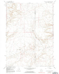
1964 Map of Butcher Knife Draw
USGS Topo · Published 1992About this map
Butcher Knife Spring and Shurtliff Spring serve as critical water points in this arid corridor along the boundary of Uinta and Sweetwater Counties. The landscape is defined by its drainage patterns, notably Butcher Knife Draw and the distinctive Tin Can Draw, which cut through the high desert terrain. Evidence of mid-century industrial activity and land use is visible through scattered infrastructure, including a Gravel Pit, a remote Landing Area, and several Gas Wells. The network of seasonal watercourses like Big Dry Creek and Dry Wash illustrates the challenging environment where these few named springs provided essential resources for livestock and early travel through the southwestern Wyoming draws.
Find a feature on this map
15 named features on this map. Tap any name to fly to it.
Don’t see what you’re looking for? This feature index may not catch every label — zoom into the map to look around manually.
Map Details
Editions of this 1964 Butcher Knife Draw Map
2 editions found
Other maps of this area

1954 · Ogden
USGS Topo · 1:250,000

1954 · Rock Springs
USGS Topo · 1:250,000

1958 · Ogden
USGS Topo · 1:250,000

1958 · Rock Springs
USGS Topo · 1:250,000

1960 · Ogden
USGS Topo · 1:250,000

1962 · Rock Springs
USGS Topo · 1:250,000

1964 · Butcher Knife Draw
USGS Topo · 1:24,000

1964 · Soap Holes Reservoir
USGS Topo · 1:24,000

1964 · Reed Reservoir
USGS Topo · 1:24,000

1964 · Antelope Knoll
USGS Topo · 1:24,000