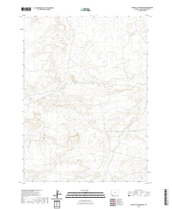
2021 Map of Winter Fat Reservoir
USGS Topo · Published 2021About this map
Winter Fat Reservoir serves as a primary reference point in this corner of Sweetwater County, where the high desert landscape is defined by its drainage systems and public land divisions. The seasonal waters of Big Dry Cr meander through the northern sections of the map, illustrating the arid hydrology typical of this part of Wyoming. This 2021 survey provides a contemporary perspective on the township and range boundaries that have organized this region since the original land surveys, including t15n r110w and t16n r110w. The absence of developed settlements highlights the remote, open character of the terrain, offering a clear view of the topography surrounding these critical water-retention features.
Find a feature on this map
7 named features on this map. Tap any name to fly to it.
Don’t see what you’re looking for? This feature index may not catch every label — zoom into the map to look around manually.
Map Details
Editions of this 2021 Winter Fat Reservoir Map
This is the sole edition of this map. No revisions or reprints were ever made.
Other maps of this area

1954 · Rock Springs
USGS Topo · 1:250,000

1957 · Mc Kinnon Junction
USGS Topo · 1:62,500

1958 · Rock Springs
USGS Topo · 1:250,000

1962 · Rock Springs
USGS Topo · 1:250,000

1964 · Antelope Knoll NE
USGS Topo · 1:24,000

1964 · Black Spring Reservoir
USGS Topo · 1:24,000

1964 · Antelope Knoll
USGS Topo · 1:24,000

1964 · Winter Fat Reservoir
USGS Topo · 1:24,000
1964 · Horse Ranch
USGS Topo · 1:24,000
1964 · Needle Reservoir
USGS Topo · 1:24,000