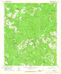
1965 Map of Winterseat
USGS Topo · Published 1967About this map
Winterseat serves as a central landmark in this mid-1960s landscape, situated within a region characterized by the sprawling Sumter National Forest. The map reveals a community defined by its rural institutions and the dense network of tributaries feeding into Cuffytown Creek and Stevens Creek. Genealogical interest is found in the distribution of country churches such as Mt Harmony Ch and Tranquil Ch, alongside numerous unnamed cemeteries that dot the timbered terrain. The presence of a Community Hall and a Lookout Tower near Liberty Hill suggests a landscape managed for both social gathering and forestry protection. Historical transportation routes, including Ferry Road and Scotts Ferry Road, hint at older river crossings and travel patterns that preceded modern highway developments, while the borders of Greenwood, McCormick, and Edgefield counties converge across these wooded ridges and creek bottoms.
Find a feature on this map
41 named features on this map. Tap any name to fly to it.
Don’t see what you’re looking for? This feature index may not catch every label — zoom into the map to look around manually.
Map Details
Editions of this 1965 Winterseat Map
2 editions found
Other maps of this area

1892 · Mc Cormick
USGS Topo · 1:125,000

1892 · Abbeville
USGS Topo · 1:125,000

1908 · Kirksey
USGS Topo · 1:24,000

1912 · Mc Cormick
USGS Topo · 1:125,000

1948 · Verdery
USGS Topo · 1:24,000

1950 · Bradley
USGS Topo · 1:24,000

1950 · Kirksey
USGS Topo · 1:24,000

1950 · Verdery
USGS Topo · 1:24,000

1953 · Athens
USGS Topo · 1:250,000

1954 · Greenville
USGS Topo · 1:250,000