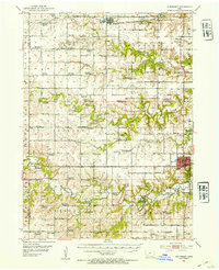
1952 Map of Winterset
USGS Topo · Published 1954About this map
The Winterset landscape in the early 1950s is defined by a dense network of rural infrastructure, where the Middle River and North River systems carve through the terrain. This era of consolidation is visible in the numerous educational sites marked as abandoned, such as School No 5 (Abandoned) and Washington Sch (Abandoned), while facilities like the Douglas Center Sch and Lincoln Sch remain active. The presence of the Pammel State Park highlights the local geography with the notable Harmon Tunnel, a rare engineering feature in this agricultural setting.
Find a feature on this map
66 named features on this map. Tap any name to fly to it.
Don’t see what you’re looking for? This feature index may not catch every label — zoom into the map to look around manually.
Map Details
Editions of this 1952 Winterset Map
2 editions found
Other maps of this area

1908 · Waukee
USGS Topo · 1:62,500

1949 · Adel
USGS Topo · 1:62,500

1951 · Adel
USGS Topo · 1:62,500

1951 · Osceola
USGS Topo · 1:62,500

1951 · St. Charles
USGS Topo · 1:62,500

1951 · Afton
USGS Topo · 1:62,500

1952 · Panora
USGS Topo · 1:62,500

1952 · Winterset
USGS Topo · 1:62,500

1954 · Greenfield
USGS Topo · 1:62,500

1954 · Omaha
USGS Topo · 1:250,000