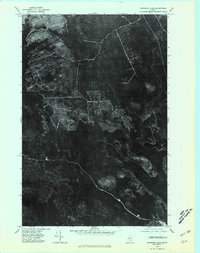
1975 Map of Winterville SE
USGS Topo · Published 1981About this map
Portage Lake dominates the southeastern portion of this 1975 orthophotograph, a specialized aerial survey that provides a direct visual record of the Aroostook County timberlands during the mid-1970s. The imagery reveals the complex network of logging roads and clearings carved into the forest canopy, particularly around the northern slopes of West Mountain. This industrial landscape is defined by the drainage patterns of the Fish River and its tributary, Mosquito Brook, which cut through the dense vegetation. Unlike traditional line-drawn maps, this photo-quadrangle captures the specific texture of the Maine woods, showing the precise extent of contemporary timber harvesting operations and the varied density of the second-growth forest at this specific moment in time.
Find a feature on this map
4 named features on this map. Tap any name to fly to it.
Don’t see what you’re looking for? This feature index may not catch every label — zoom into the map to look around manually.
Map Details
Editions of this 1975 Winterville SE Map
This is the sole edition of this map. No revisions or reprints were ever made.
Other maps of this area

1928 · Winterville
USGS Topo · 1:48,000

1929 · Portage
USGS Topo · 1:62,500

1930 · Greenlaw
USGS Topo · 1:48,000

1931 · Ashland
USGS Topo · 1:48,000

1931 · Portage
USGS Topo · 1:62,500

1931 · Winterville
USGS Topo · 1:62,500

1933 · Greenlaw
USGS Topo · 1:62,500

1934 · Ashland
USGS Topo · 1:62,500

1953 · Ashland
USGS Topo · 1:62,500

1953 · Portage
USGS Topo · 1:62,500