2002 Map of Winthrop
USGS Topo · Published 2006About this map
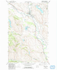
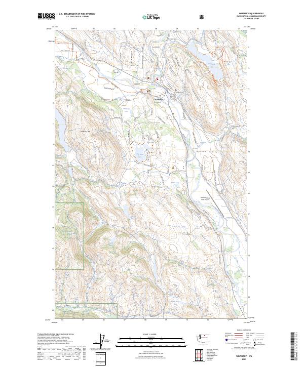
Winthrop serves as the hub of the Methow Valley in this early 21st-century record, where the Methow River meets Wolf Creek. The town is surrounded by extensive protected lands, including the Methow State Wildlife Area and Okanogan National Forest, reflecting a landscape managed for both recreation and conservation. Notable infrastructure includes the Intercity Airport and the specialized North Cascades Smoke Jumper Base, critical for regional firefighting efforts. Local education and community life are anchored by the Liberty Bell High School complex and the Winthrop National Fish Hatchery. The presence of Sullivan Cem and other cemeteries provides a vital link for genealogists tracking early valley residents, while the distribution of Gravel Pits and irrigation works like the Diversion Dam illustrate the valley's ongoing reliance on its natural resources and river system.
Find a feature on this map
38 named features on this map. Tap any name to fly to it.
Don’t see what you’re looking for? This feature index may not catch every label — zoom into the map to look around manually.
Map Details
Editions of this 2002 Winthrop Map
This is the sole edition of this map. No revisions or reprints were ever made.
Historical Maps of Winthrop Through Time
3 maps found