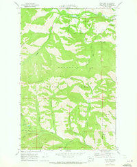
1969 Map of Twisp West
USGS Topo · Published 1973About this map
The Okanogan National Forest dominates this 1969 topographic study, capturing a landscape defined by deep canyons and industrial potential. High-elevation vantage points like the Lookout Tower atop Lookout Mtn overlook a complex drainage system including Poorman Creek and the southern reaches of the Twisp River. The map provides a detailed record of late-1960s resource exploration, highlighting the Alder Mine and various unnamed Mines and a Prospect scattered along the ridge lines and canyon walls. An intricate network of Pack Trails and Jeep Trails provides the primary access through this steep terrain, linking remote features like Elbow Canyon and Smith Canyon. This survey captures the region just before modern forest management practices evolved, showing the original National Forest Boundary and the proximity of these extractive sites to significant water sources like Libby Creek.
Find a feature on this map
31 named features on this map. Tap any name to fly to it.
Don’t see what you’re looking for? This feature index may not catch every label — zoom into the map to look around manually.
Map Details
Editions of this 1969 Twisp West Map
2 editions found
Other maps of this area

1899 · Methow
USGS Topo · 1:125,000

1901 · Methow
USGS Topo · 1:125,000

1955 · Concrete
USGS Topo · 1:250,000

1958 · Concrete
USGS Topo · 1:250,000

1962 · Concrete
USGS Topo · 1:250,000
1968 · Methow
USGS Topo · 1:24,000
1968 · Hungry Mtn
USGS Topo · 1:24,000
1969 · Martin Peak
USGS Topo · 1:24,000
1969 · Thompson Ridge
USGS Topo · 1:24,000
1969 · Buttermilk Butte
USGS Topo · 1:62,500