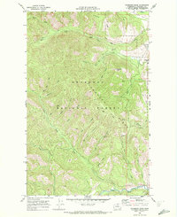
1969 Map of Thompson Ridge
USGS Topo · Published 1972About this map
Thompson Ridge dominates this 1960s landscape within the Okanogan National Forest, where a complex network of resource management and wilderness access is visible. The map detail highlights an extensive water-management system along Wolf Creek, featuring a Diversion Dam, a Siphon, and an Aqueduct that contours around the steep slopes. While much of the terrain is defined by drainages like Little Wolf Creek and Bridge Creek, the presence of a Landing Strip near Patterson Lake and numerous segments of Pack Trail and Jeep Trail illustrate the era's reliance on specialized transport for forest monitoring and high-country transit. To the north, the Methow Valley floor begins to broaden, contrasting with the high-elevation landmarks such as Gobblers Knob and the prominent Virginian Ridge.
Find a feature on this map
36 named features on this map. Tap any name to fly to it.
Don’t see what you’re looking for? This feature index may not catch every label — zoom into the map to look around manually.
Map Details
Editions of this 1969 Thompson Ridge Map
This is the sole edition of this map. No revisions or reprints were ever made.
Other maps of this area

1899 · Methow
USGS Topo · 1:125,000

1901 · Methow
USGS Topo · 1:125,000

1955 · Concrete
USGS Topo · 1:250,000

1958 · Concrete
USGS Topo · 1:250,000

1962 · Concrete
USGS Topo · 1:250,000

1962 · Mazama
USGS Topo · 1:62,500

1963 · Doe Mountain
USGS Topo · 1:62,500
1969 · Midnight Mtn.
USGS Topo · 1:24,000
1969 · Buttermilk Butte
USGS Topo · 1:62,500
1969 · Twisp West
USGS Topo · 1:24,000