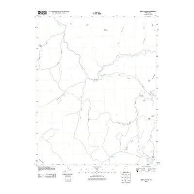
2010 Map of Wirt Canyon
USGS Topo · Published 2010About this map
The Navajo River snakes through this high-altitude landscape in Rio Arriba County, defining a complex topography of deep canyons and prominent mesas. The small settlement of Navajo is situated along the river's northern bend, while the larger community of Dulce sits to the southeast near the junction of Amargo Creek and Dulce Creek. The map documents a rugged interior network of family-named landmarks and water sources, including Martinez Pond, Button-Thomas Spring, and the Dulce Lake Dam.
Find a feature on this map
37 named features on this map. Tap any name to fly to it.
Don’t see what you’re looking for? This feature index may not catch every label — zoom into the map to look around manually.
Map Details
Editions of this 2010 Wirt Canyon Map
This is the sole edition of this map. No revisions or reprints were ever made.
Other maps of this area

1889 · Largo
USGS Topo · 1:250,000

1895 · Largo
USGS Topo · 1:250,000

1913 · Summitville
USGS Topo · 1:125,000

1915 · Summitville
USGS Topo · 1:125,000

1924 · Pagosa Springs
USGS Topo · 1:125,000

1927 · Pagosa Springs
USGS Topo · 1:125,000

1945 · Durango
USGS Topo · 1:250,000

1953 · Durango
USGS Topo · 1:250,000

1954 · Durango
USGS Topo · 1:250,000

1954 · Aztec
USGS Topo · 1:250,000