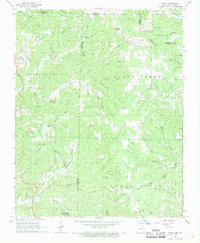
1968 Map of Wirth
USGS Topo · Published 1969About this map
Wolf Creek and Fox Creek carve through the landscape along the border of Arkansas and Missouri in the late 1960s. This survey, conducted by the USGS and the Arkansas Geological Commission, documents a rural landscape defined by small community hubs and family-named landmarks. The settlement of Wirth sits near the eastern edge, while the southwestern corner features the neighborhood of Woodland Hills. Numerous small quarries and a gravel pit suggest local industry focused on the area's geological resources. Religious and educational life is anchored by the Mennonite Church and Mennonite School, alongside several other country houses of worship including Union Hill Church and New Hope Church. Local genealogy is well-preserved through several family-named burial grounds like Ed Collins Cemetery and the Hurst Cemetery, many situated atop high points such as Britton Hill.
Find a feature on this map
70 named features on this map. Tap any name to fly to it.
Don’t see what you’re looking for? This feature index may not catch every label — zoom into the map to look around manually.
Map Details
Editions of this 1968 Wirth Map
2 editions found
Other maps of this area

1943 · Thayer
USGS Topo · 1:62,500

1944 · Couch
USGS Topo · 1:62,500

1946 · Thayer
USGS Topo · 1:62,500

1946 · Couch
USGS Topo · 1:62,500

1957 · Poplar Bluff
USGS Topo · 1:250,000

1959 · Poplar Bluff
USGS Topo · 1:250,000

1960 · Poplar Bluff
USGS Topo · 1:250,000

1962 · Stuart
USGS Topo · 1:24,000

1962 · Mammoth Spring
USGS Topo · 1:24,000

1968 · Hardy
USGS Topo · 1:24,000