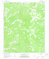
1968 Map of Wirth
USGS Topo · Published 1981About this map
The borderlands of Missouri and Arkansas converge in this 1968 survey of Sharp and Fulton counties, a landscape defined by an intricate network of springs and hollows. Small rural communities like Wirth and Woodland Hills anchor the area, while the uplands are marked by numerous family-named cemeteries and country churches, such as the Mennonite Cem Sch and Pleasant Ridge Ch. This period reveals a predominantly agricultural and timber-based economy, with topographic detail showing the scattered homesteads and narrow valleys of Maccasin Creek and Wolf Creek.
Find a feature on this map
88 named features on this map. Tap any name to fly to it.
Don’t see what you’re looking for? This feature index may not catch every label — zoom into the map to look around manually.
Map Details
Editions of this 1968 Wirth Map
2 editions found
Other maps of this area

1943 · Thayer
USGS Topo · 1:62,500

1944 · Couch
USGS Topo · 1:62,500

1946 · Thayer
USGS Topo · 1:62,500

1946 · Couch
USGS Topo · 1:62,500

1957 · Poplar Bluff
USGS Topo · 1:250,000

1959 · Poplar Bluff
USGS Topo · 1:250,000

1960 · Poplar Bluff
USGS Topo · 1:250,000

1962 · Stuart
USGS Topo · 1:24,000

1962 · Mammoth Spring
USGS Topo · 1:24,000

1968 · Hardy
USGS Topo · 1:24,000