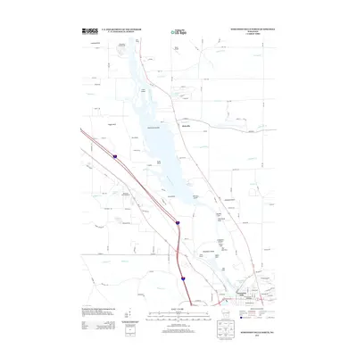
2013 Map of Wisconsin Dells North
USGS Topo · Published 2013About this map
The Wisconsin River carves through the sandstone landscape north of Wisconsin Dells, revealing the geological formations that have long defined this region. This survey captures the intricate river system as it flows past The Narrows and around Blackhawk Island, where the water has shaped distinct landmarks like Steamboat Rock and Stand Rock. The topography is marked by numerous glens and canyons, including Witches Gulch, Coldwater Canyon, and Artist Glen, which transition into the flatter settlement area of Plainville to the north.
Find a feature on this map
111 named features on this map. Tap any name to fly to it.
Don’t see what you’re looking for? This feature index may not catch every label — zoom into the map to look around manually.
Map Details
Editions of this 2013 Wisconsin Dells North Map
This is the sole edition of this map. No revisions or reprints were ever made.
Other maps of this area

1901 · The Dells
USGS Topo · 1:62,500

1902 · Briggsville
USGS Topo · 1:62,500

1957 · Wisconsin Dells
USGS Topo · 1:62,500

1957 · Madison
USGS Topo · 1:250,000

1958 · Briggsville
USGS Topo · 1:62,500

1960 · Madison
USGS Topo · 1:250,000

1961 · Oxford
USGS Topo · 1:62,500

1961 · Adams
USGS Topo · 1:62,500
1975 · Wisconsin Dells NW
USGS Topo · 1:24,000
1975 · Wisconsin Dells SE
USGS Topo · 1:24,000