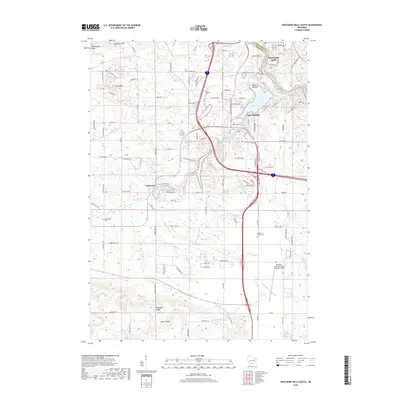
2018 Map of Wisconsin Dells South
USGS Topo · Published 2018About this map
Lake Delton and the bend of the Wisconsin River anchor this 2018 survey of the Sauk and Columbia County line. The landscape is defined by the complex hydrography of the region, where Dell Creek feeds into Mirror Lake before joining the main river system near Wisconsin Dells. This era shows the dense development of the resort area around Lake of the Dells, contrasted by the more rugged, natural terrain of the North Range and Hogsback Ridge to the south. Local heritage is preserved in several rural burial grounds, including Mount Pleasant Cem, Butterfield Cem, and Webster Prairie Cem. Transportation is dominated by the corridor of Interstate 90 and 94, which bisects the quadrangle, while the Baraboo-Wisconsin Dells Regional Airport serves as a modern hub for the area. Smaller settlements like Dellwood sit nestled near the numerous sloughs and creeks, such as Pickerel Slough and Beaver Cr, that carve through the local sandstone topography.
Find a feature on this map
98 named features on this map. Tap any name to fly to it.
Don’t see what you’re looking for? This feature index may not catch every label — zoom into the map to look around manually.
Map Details
Editions of this 2018 Wisconsin Dells South Map
This is the sole edition of this map. No revisions or reprints were ever made.
Other maps of this area

1895 · Baraboo
USGS Topo · 1:62,500

1901 · Denzer
USGS Topo · 1:62,500

1901 · The Dells
USGS Topo · 1:62,500

1902 · Briggsville
USGS Topo · 1:62,500

1908 · Baraboo
USGS Topo · 1:62,500

1957 · Wisconsin Dells
USGS Topo · 1:62,500

1957 · Madison
USGS Topo · 1:250,000

1958 · Briggsville
USGS Topo · 1:62,500

1958 · North Freedom
USGS Topo · 1:62,500

1959 · Baraboo
USGS Topo · 1:62,500