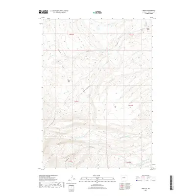
2017 Map of Wise Flat
USGS Topo · Published 2017About this map
Wise Flat and Norkok Butte anchor this high-elevation landscape in Fremont County, where the terrain descends from the ridges of the Wind River Range. The sheet is defined by the deep drainage patterns of the North Fork Little Wind River and the South Fork Little Wind River, which flow across the southern sections of the quadrangle. Early 21st-century access is provided by several primitive routes, including the Saint Lawrence Ranger Station Rd and the Washakie Park Rd, which wind through the township boundaries of T1N and T2N. Local landmarks like the Red Basin and Norkok Meadows Cr highlight the intricate topography of this region, which remains largely undeveloped, characterized by seasonal creeks and prominent natural features instead of dense settlements.
Find a feature on this map
24 named features on this map. Tap any name to fly to it.
Don’t see what you’re looking for? This feature index may not catch every label — zoom into the map to look around manually.
Map Details
Editions of this 2017 Wise Flat Map
This is the sole edition of this map. No revisions or reprints were ever made.
Other maps of this area

1937 · Moccasin Lake
USGS Topo · 1:48,000

1943 · Moccasin Lake
USGS Topo · 1:62,500

1951 · Fort Washakie
USGS Topo · 1:24,000

1951 · Bull Lake East
USGS Topo · 1:24,000

1951 · Argo Butte
USGS Topo · 1:24,000

1952 · Wise Flat
USGS Topo · 1:24,000

1952 · Wind River
USGS Topo · 1:24,000

1952 · Bull Lake West
USGS Topo · 1:24,000

1952 · St. Lawrence Basin
USGS Topo · 1:24,000

1955 · Thermopolis
USGS Topo · 1:250,000