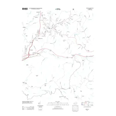
2013 Map of Wise
USGS Topo · Published 2013About this map
Wise and the surrounding plateau of Wise County serve as the focal point of this study, illustrating the modern layout of this Appalachian community. The landscape is defined by the headwaters of the Guest River and its numerous tributaries such as Bear Cr and Yellow Cr, which wind through the dissected terrain. A dense network of local roads and state routes connects established neighborhoods like Hamilton Town, Esserville, and Glamorgan, while the southern reaches of the quadrangle transition into the more sparsely populated ridges of the Jefferson National Forest. High-altitude landmarks such as the Wise Mountain Lookout Tower and Pickem Mountain stand alongside more contemporary developments like the Lonesome Pine Airport. Local history is embedded in the terrain at Parson Gap and Osborn Rock, while institutional sites like Camp Bethel and the Intermont Girl-Scout Camp reflect the long-standing community and recreational infrastructure of the area.
Find a feature on this map
189 named features on this map. Tap any name to fly to it.
Don’t see what you’re looking for? This feature index may not catch every label — zoom into the map to look around manually.
Map Details
Editions of this 2013 Wise Map
This is the sole edition of this map. No revisions or reprints were ever made.
Other maps of this area

1886 · Grundy
USGS Topo · 1:125,000

1890 · Whitesburg
USGS Topo · 1:125,000

1890 · Grundy
USGS Topo · 1:125,000

1892 · Grundy
USGS Topo · 1:125,000

1892 · Whitesburg
USGS Topo · 1:125,000

1894 · Estillville
USGS Topo · 1:125,000

1897 · Bristol
USGS Topo · 1:125,000

1902 · Bristol
USGS Topo · 1:125,000

1912 · Pound
USGS Topo · 1:48,000

1913 · Clintwood
USGS Topo · 1:62,500