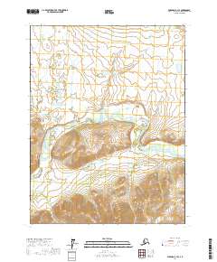
2017 Map of Wiseman A-1 SE
USGS Topo · Published 2017About this map
The South Fork Koyukuk River winds through this subarctic interior, defining a landscape dominated by extensive wetlands and seasonal watercourses. This 2017 survey by the U.S. Geological Survey illustrates the hydrological complexity of the Yukon-Koyukuk region, where tributaries like Wilson Cr and Hidden Cr feed the primary river system. A prominent topographic landmark, Eagle Cliff, rises above the northern bank of the river, providing a significant navigational point in an otherwise undulating terrain of lowlands and marshes. The lack of road infrastructure on this sheet emphasizes the remote character of the Koyukuk drainage, where travel remains dictated by river corridors and the natural relief of the land.
Find a feature on this map
10 named features on this map. Tap any name to fly to it.
Don’t see what you’re looking for? This feature index may not catch every label — zoom into the map to look around manually.
Map Details
Editions of this 2017 Wiseman A-1 SE Map
This is the sole edition of this map. No revisions or reprints were ever made.
Other maps of this area

1951 · Bettles
USGS Topo · 1:250,000

1951 · Chandalar
USGS Topo · 1:250,000

1951 · Beaver
USGS Topo · 1:250,000

1951 · Wiseman
USGS Topo · 1:250,000

1956 · Chandalar
USGS Topo · 1:250,000

1956 · Bettles
USGS Topo · 1:250,000

1956 · Wiseman
USGS Topo · 1:250,000

1956 · Beaver
USGS Topo · 1:250,000

1964 · Wiseman
USGS Topo · 1:250,000

1964 · Chandalar
USGS Topo · 1:250,000