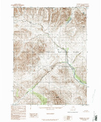
1986 Map of Wiseman D-6
USGS Topo · Published 1986About this map
Gates of the Arctic National Park and the Gates of the Arctic Wilderness dominate this Brooks Range landscape as it was documented in the mid-1980s. The area is defined by significant drainage systems, most notably the Hunt Fork John River which flows through the eastern portion of the quadrangle. High alpine terrain is anchored by peaks such as Sillyasheen Mountain and Ursus Peak, with the latter standing near the headwaters of Loon Creek and the quiet waters of Loon Lake.
Find a feature on this map
13 named features on this map. Tap any name to fly to it.
Don’t see what you’re looking for? This feature index may not catch every label — zoom into the map to look around manually.
Map Details
Editions of this 1986 Wiseman D-6 Map
This is the sole edition of this map. No revisions or reprints were ever made.
Other maps of this area

1951 · Survey Pass
USGS Topo · 1:250,000

1951 · Chandler Lake
USGS Topo · 1:250,000

1951 · Killik River
USGS Topo · 1:250,000

1951 · Wiseman
USGS Topo · 1:250,000

1956 · Wiseman
USGS Topo · 1:250,000

1956 · Survey Pass
USGS Topo · 1:250,000

1956 · Chandler Lake
USGS Topo · 1:250,000

1956 · Killik River
USGS Topo · 1:250,000

1964 · Survey Pass
USGS Topo · 1:250,000

1964 · Wiseman
USGS Topo · 1:250,000