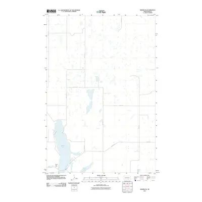
2011 Map of Wishek NE
USGS Topo · Published 2011About this map
Beaver Lake dominates the southwestern corner of this Logan County landscape, a significant water body formed behind the Beaver Lake Dam along Beaver Creek. The terrain is characterized by the glaciated prairie pothole region of North Dakota, dotted with numerous unnamed smaller wetlands and larger permanent waters such as Island Lake and Doyles Lake. A structured grid of section-line roads, including Burnstad Rd and Bainstad Rd, organizes the rural space, indicating the persistent influence of the original land surveys on the modern agricultural layout. The map reflects a sparsely populated area where the natural hydrology and the rectilinear road network are the primary human imprints on the land.
Find a feature on this map
16 named features on this map. Tap any name to fly to it.
Don’t see what you’re looking for? This feature index may not catch every label — zoom into the map to look around manually.
Map Details
Editions of this 2011 Wishek NE Map
This is the sole edition of this map. No revisions or reprints were ever made.
Other maps of this area

1953 · Jamestown
USGS Topo · 1:250,000

1956 · Jamestown
USGS Topo · 1:250,000

1982 · Wishek SW
USGS Topo · 1:24,000

1982 · Wishek NE
USGS Topo · 1:24,000

1982 · Burnstad
USGS Topo · 1:24,000

1982 · Lehr NW
USGS Topo · 1:24,000

1982 · Lehr SW
USGS Topo · 1:24,000

1982 · Wishek
USGS Topo · 1:24,000

1983 · Streeter SW
USGS Topo · 1:24,000

1983 · Alkaline Lake SW
USGS Topo · 1:24,000